Scientific Groundwater & Geothermal Intelligence & Risk Assessment For Farms, Hotels, Residences, Textile & Industrial Projects Across India
GPR Assessment · GPS Drill Targeting · Borewell Audit & Riskt | Powered By Aquafuture
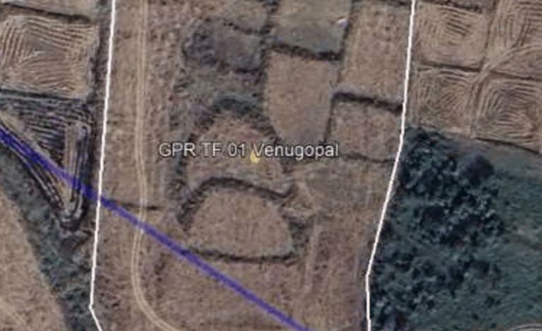
TerraFlow Solutions India is the official India partner of Aquafuture Solutions S.L., Barcelona — delivering satellite-based groundwater risk assessment across India. Before you drill, we map the subsurface. Our Ground Property Report (GPR) identifies rechargeable groundwater veins, aquifer depth, and yield potential usingquafuture's proprietary AI engine — integrating Copernicus and Sentinel satellite imagery for macro-environmental analysis, Landsat and Google Earth Engine data for geological and topographical mapping, and LiDAR and Radar Altimetry for deep structural fracture detection. Every assessment is processed through AI-driven geological modeling and global geological database archives — entirely remotely, with no site visits required. Delivery in 48 hours. Trusted by real estate developers, EPC contractors, and infrastructure project owners across India.
Thermal Water Discovery — Powered by Aquafuture
The same satellite intelligence that maps groundwater also identifies deep thermal veins — unlocking spa, wellness, and geothermal opportunities invisible to traditional surveys.
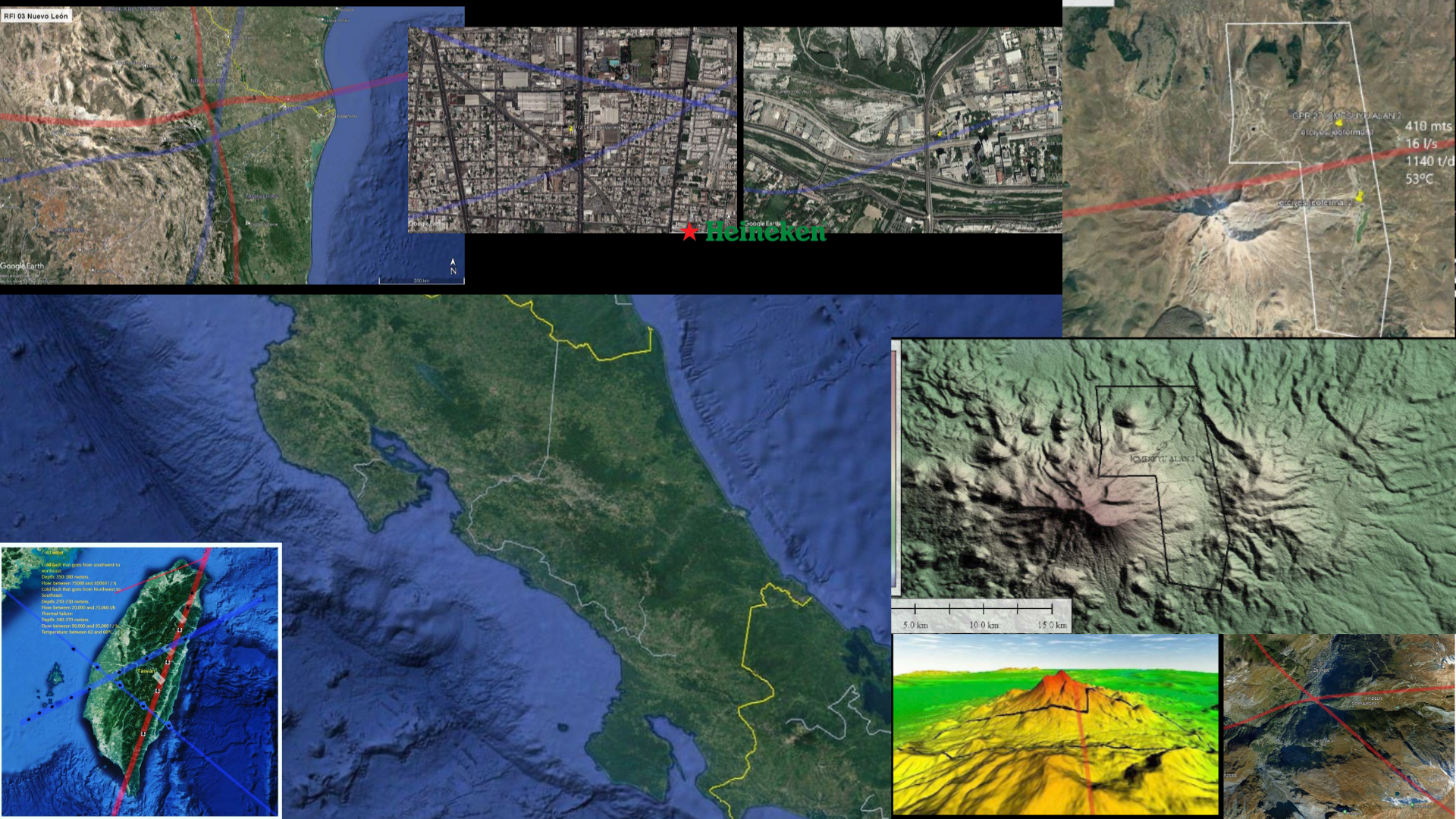
🌡️ Llívia Thermal Pool — Pyrenees, Spain A municipal study revealed a thermal vein crossing a park. Aquafuture pinpointed the drill location. Thermal pools are now built and open to the public. Depth: 570–590m | Flow: 15–20 m³/h | Temperature: 30°C
🌡️ Dubai — Crown Prince Office Three water types identified across the territory — including a major thermal vein at 830–900m running west to east at 48–63°C. Four wells drilled, all confirmed. Thermal water now supplies a private club. Depth: 450–890m | Flow: 40–160 m³/h | Temperature: 48–63°C
TerraFlow delivers the same thermal vein detection capability across India — for wellness resorts, spa developments, and geothermal infrastructure.
TerraFlow Solutions serves landowners, real estate developers, pharma facilities, and industrial projects across Telangana, Andhra Pradesh, Karnataka, Tamil Nadu, Kerala, Maharashtra, Madhya Pradesh, Rajasthan, Gujarat, Punjab, Haryana, Uttar Pradesh, Bihar, Odisha, Jharkhand, and West Bengal — delivering satellite-based groundwater assessment, GPR & GPS borewell drill-point targeting, and production borewell audit & risk management. No site visits. 48-hour delivery. — 100% Remotely
Backed by Aquafuture's methodology — applied globally since 2018, We've helped clients eliminate groundwater risk through satellite intelligence.
We help real estate developers, industrial planners, and government bodies across India identify subsurface water risk before capital is deployed. As the Official India Partner of Aquafuture, we combine AI-driven satellite technology with over 20 years of groundwater drilling expertise — delivering institutional-grade hydro intelligence, 100% remotely.
✓ Pre-Acquisition Hydro Risk Assessment
✓ Satellite Groundwater Vein Mapping
✓. Recharge Sustainability Analysis
✓. Strategic Drilling & CAPEX Advisory
1200+
Wells Completed
14+
Countries Served
With a 90% Success rate, our satellite groundwater intelligence has helped developers and industries across 14+ countries eliminate subsurface risk worth crores — before a single borewell is drilled.
Active & Growing
India Operations
90%
with Succes rate
1,200+
Wells Completed Globally
20+
Years of Industry Expertise
Our Proven Satellite Process to Eliminate Your Risk

Locate & Analyse
You share your land coordinates. We run a full multi-layer satellite analysis — identifying subsurface groundwater veins, fault lines, and flow direction across your entire project footprint.

Map & Classify
We deliver a complete hydro intelligence report — vein depth, yield potential, water type, recharge sustainability, and risk classification. In 48 Hours. No site visit required.

Drill & Deploy
Hand our report to any local drilling contractor. They drill exactly where we say. +90% success rate. Zero wasted boreholes. Full CAPEX confidence.

Delivering Groundwater Intelligence Through Satellite Excellence
Pre-Acquisition Hydro Risk Assessment
Identify and quantify groundwater risk before land acquisition or capital deployment — eliminating the most overlooked variable in real estate and industrial development.
Satellite Groundwater Mapping
Our AI-driven satellite framework analyses subsurface structures across any land parcel in India — 100% remotely, no field visit required, delivered in 48 Hours.
Sustainability & Monitoring Advisory
Long-term groundwater governance planning aligned with project CAPEX cycles and regulatory compliance requirements.
Borewell Audit & Risk Management
Your Borewell Is Running.
But Is It Running Right?
Satellite-verified analysis of your existing groundwater source — recharge status, depletion risk, extraction optimization. No site visits. 48-hour delivery.
Is this you?
01
Your borewell production is not meeting demand
02
You suspect overexploitation or underutilization
03
Flow drops every summer — seasonal variation is hurting you
04
You've noticed a steady decline in borewell yield
05
You don't know how many years your aquifer vein will last
06
You've drilled — but never audited what you actually have
The Value Behind Our Partnership
Every year across India, developers and industries drill blind. No scientific evidence. No subsurface data. Just a local geologist's instinct, a divining rod, or hope. The result? A dry borewell at 800 feet. Lakhs gone. Six months lost. A project stalled. A family's investment wasted.
This has been the painful reality of traditional groundwater surveys in India for decades — outdated methods, unscientific guesswork, and zero accountability when the well runs dry.
Our partnership exists to end that story permanently.
We go beyond consulting to become your strategic groundwater partner — bringing the same satellite intelligence trusted by Tesla GigaFactory, Heineken, and the Dubai Crown Prince Office — now protecting Indian developers, farmers, and industries from crores in avoidable loss.
No guesswork. No divining rods. No dry wells.
Just satellite precision — before you spend a single rupee underground.
• Deep Collaboration Zero Dry Wells Crores Saved
We work side by side with your development and infrastructure teams — integrating groundwater risk intelligence directly into your pre-acquisition due diligence and CAPEX planning. As the Official India Partner of Aquafuture, trusted globally by Tesla, Heineken, and the Dubai Crown Prince Office — we ensure no surprises below ground, and no wasted capital above it.


Stop Drilling Blind. Start Drilling Smart.
✓ Share Your Land Coordinates — We Do The Rest
✓ Receive Full Satellite Groundwater Report In 48 Hours
✓ Drill With Confidence

Frequently asked questions
What is TerraFlow Solutions India? TerraFlow Solutions India is a geological knowledge company delivering satellite-based groundwater intelligence to landowners, farmers, and real estate developers across India. We are the Official India Partner of Aquafuture Solutions, Barcelona — no site visits, pure data intelligence.
How does the Ground Property Report (GPR) work? You provide your site coordinates. Our partner Aquafuture processes your land through satellite imagery, geological database archives, structural analysis, and AI-driven hydrological modelling. Within 48 hours, you receive a full groundwater intelligence report — depth, flow rate, formation type, and risk profile.
What is the Ground Positioning Service (GPS)? The GPS service identifies the single optimal borewell location on your site — giving you exact drilling coordinates and final point prioritization before your rig arrives. It eliminates dry holes, wasted drilling costs, and repeated attempts.
How much does it cost? Pricing depends on your land size, location, and the service required. Contact us for a project-specific quote. Our reports typically save clients multiples of the assessment cost by preventing failed borewells and poor drilling decisions.
Do you visit the site? No. That is the core of what we do. Your coordinates are all we need. Aquafuture's remote analytical engine does the rest — making TerraFlow the only groundwater intelligence service in India that requires zero site visits.
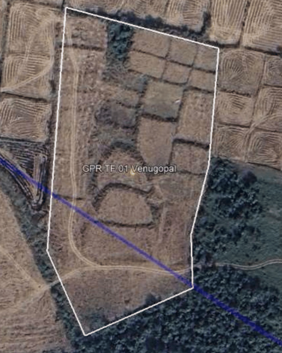
Where can I see proof that this works? Our project in Laxmapoor Village, Nizamabad District, Telangana — Water was struck exactly at the GPR-predicted depth and flow rate. The GPS-identified drill coordinates were used on site. Both services validated together in a single project outcome.