Satellite Groundwater Intelligence Designed for India's Future
GPR Assessment · GPS Drill Targeting · Borewell Audit & Risk
From farms and villages in Telangana, Andhra Pradesh, Karnataka, Tamil Nadu, Kerala, Maharashtra, Madhya Pradesh, Rajasthan, Gujarat, Punjab, Haryana, Uttar Pradesh, Bihar, Odisha, Jharkhand and West Bengal — to industrial townships, real estate developments, and pharma facilities across India — TerraFlow delivers satellite-based groundwater assessment, GPS borewell drill-point targeting, and production borewell audit & risk management. Every report crafted precisely for your land, your geology, and your long-term water security.
We Serve All Over India
TerraFlow Solutions serves landowners, real estate developers, pharma facilities, and industrial projects across Telangana, Andhra Pradesh, Karnataka, Tamil Nadu, Kerala, Maharashtra, Madhya Pradesh, Rajasthan, Gujarat, Punjab, Haryana, Uttar Pradesh, Bihar, Odisha, Jharkhand, and West Bengal — delivering satellite-based groundwater assessment, GPS borewell drill-point targeting, and production borewell audit & risk management. No site visits. 48-hour delivery.
Comprehensive Groundwater Intelligence
[01]
Pre-Acquisition Hydro Risk Assessment
Identify groundwater risk before land acquisition or capital deployment — the most critical due diligence step developers skip.
✓ Subsurface vein mapping & flow direction
✓ Depth projection & yield probability
✓ Recharge sustainability classification
[02]
Satellite Groundwater Mapping
Full multi-layer satellite analysis of any land parcel across India — delivered remotely in 48 Hours with zero site visit.
✓ Google Earth Engine + Sentinel
✓ Fracture line & fault structure detection
✓ Thermal & Cold vein identification
[03]
Industrial & Manufacturing Water Security
Factories, breweries, textile mills, pharma plants — secure an independent water source before municipal supply fails you.
✓ Facility-level groundwater vein identification
✓ Flow rate & water quality classification
✓ Independent supply planning
[04]
Agricultural Groundwater Assessment
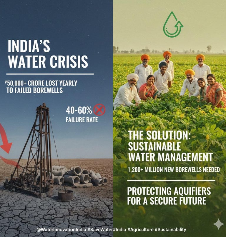
Stop losing crops to failed borewells. We find recharging veins — not depleting aquifers — so your water supply outlasts every season.
✓ Farm-level satellite vein mapping
✓ Irrigation yield & sustainability report
✓ Multi-well layout optimisation
[05]
Government & Infrastructure Advisory
District-level groundwater mapping for Jal Jeevan Mission, Smart Cities, and state water security programs — aligned with UN SDG 6.
✓ District & regional scale satellite mapping
✓ JJM & Atal Bhujal Yojana compatible
✓ Full compliance & regulatory documentation
Our Proven Satellite Process to Eliminate Your Risk

Locate & Analyse
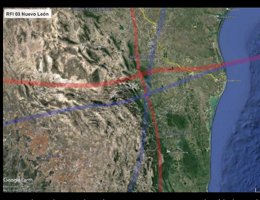
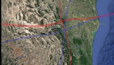
Share your land coordinates. We run full multi-layer satellite analysis — identifying subsurface groundwater veins, fault lines, and flow direction across your entire project footprint.

Map & Classify
We deliver a complete hydro intelligence report — vein depth, yield potential, water type, recharge sustainability, and risk classification. In 48 Hours. No site visit required.

Drill & Deploy
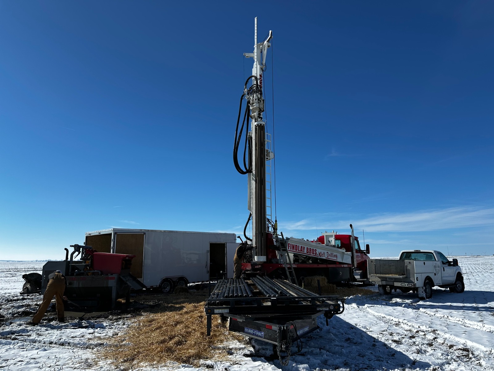
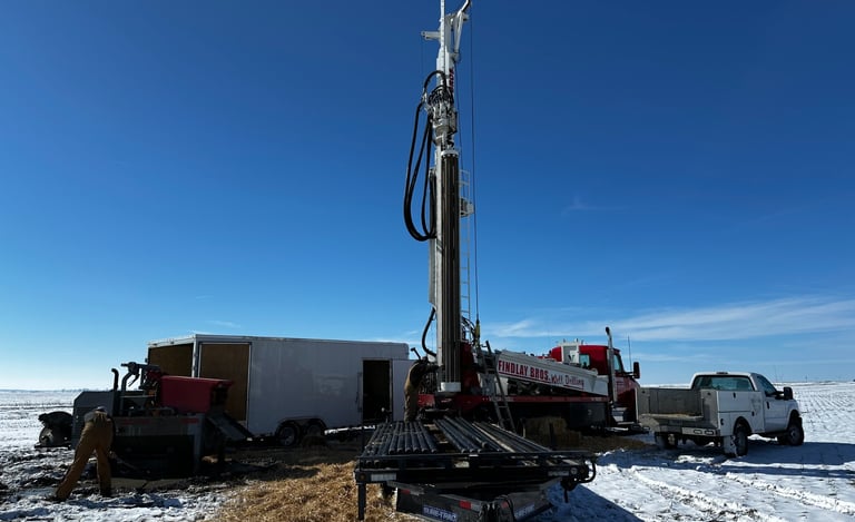
Hand our report to any local drilling contractor. They drill exactly where we say. +90% success rate. Zero wasted boreholes. Full CAPEX confidence.

Proven Results Across India & The World

7+
India Projects Completed

+90%
Drilling Success Rate

1200+
Wells Completed Globally

20+
Years Industry Expertise

Production Borewell Audit
& Risk Management
Using satellite imagery, AI-driven modeling, geological database archives, and structural analysis, we determine the precise state of your existing groundwater source — without stepping on your land.
95%
Accuracy in active recharge zones
48h
Report delivery after coordinates
20%+
Proven flow recovery rate
How it works
Three-Stage Remote Analysis
01
Data Capture
Satellite imagery, topography, thermal signatures, and geological archives are compiled for your borewell coordinates.
02
GPR Analysis
We map primary and secondary water veins — direction, depth, flow rate, temperature, and recharge potential — affecting your source.
03
Risk Report
A complete assessment of your aquifer's sustainability, depletion risk, and corrective recommendations — delivered in 48 hours.
What we diagnose
Underexploited vs Overexploited
Most borewells fall into one of two traps. Both are costly. Both are preventable.
Underexploited
nefficient use of the borewell capacity
Wasted aquifer potential — money left underground
Production below the hydric capacity of the area
Overexploited
Flow loss due to progressive depletion
Increased seasonality — summer failures
Risk of fouling from dragged formation material
Deliverables
What you receive
Full GPR Report
Depths, flow rates, vein direction, temperature — of all water veins affecting your borewell.
Risk Assessment
Recharge status, capacity calculations, depletion timeline, and overexploitation indicators.
Strategic Consulting
Recommended corrective actions, production adjustments, and alternative extraction zone options.
Annual Review Option
Annual GPR update with year-over-year vein monitoring and sustainability report for your facility.
Know what's underground.
Before it costs you.
Submit your borewell coordinates. Receive your audit in 48 hours.
[CTA]
Stop Drilling Blind. Start Drilling Smart.
✓ Share Your Land Coordinates — We Do The Rest
✓ Receive Full Satellite Groundwater Report In 48 Hours
✓ Drill With Confidence — +90% Success Rate